Blog
-
Geography vs Cartography
I believe children at geography lessons in school should learn not map of the world, but history of colonialism.
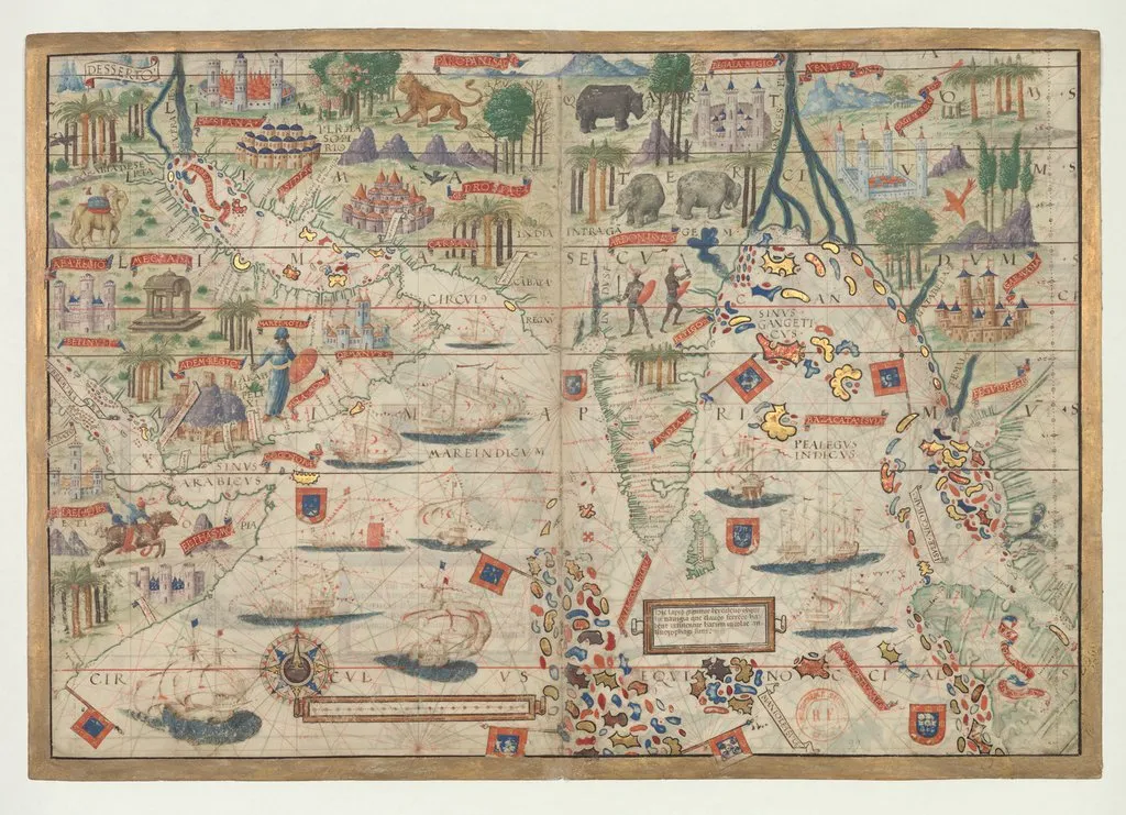
Image: Nautical Atlas of the World, Folio 3 Recto, Northern Indian Ocean with Arabia and India and Folio 3 Verso, Southern Indian Ocean with Insulindia on the Left, and Madagascar on the Right .
The map presented here is from the Miller Atlas in the collections of the National Library of France. Produced for King Manuel I of Portugal in 1519 by cartographers Pedro Reinel, his son Jorge Reinel, and Lopo Homem and miniaturist António de Holanda, the atlas contains eight maps on six loose sheets, painted on both sides. The maps were richly decorated and illuminated by António de Holanda, a Dutch native who had been in Portugal for nearly ten years.
-
Unknown Building I Know
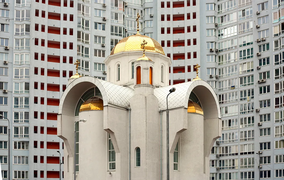
The round-shaped administrative building at Solomyanska, 13 [Солом’янська] dominants in the view from one of the rooms of my parent’s apartment. It is hard to trace the story of building; probably no research for now has been done, but currently the building hosts the State Service for Special Connection and Protection of the Information of Ukraine. For me this building has strong political meaning – since Ukraine’s independence it has been used as a voting station during elections. When I was small, my parents took me every time with them, going to vote. At the voting station apart from huge banners with biographies of candidates and their programs there was a buffet, where one of my favorite desserts was sold, milk gelatin.

-
Kyiv
Kyiv, 2016
-
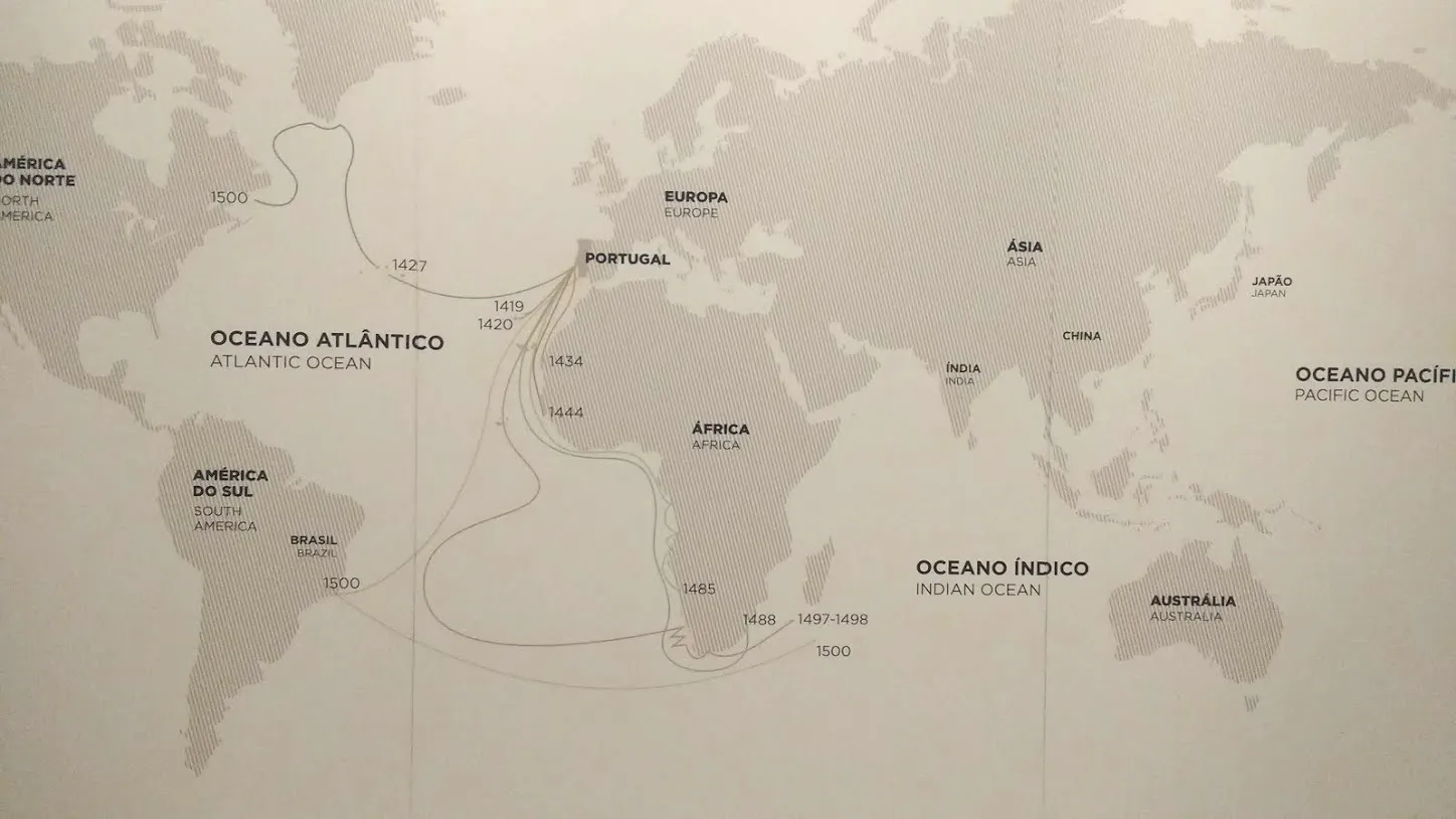
Border of the World
During the Middle Ages, the Atlantic was known as the „vast ocean”, “dark sea” or “western sea”. These different titles summarize its significance to the Western world until the beginning of the maritime explorations: a sea so vast and so dangerous that it was regarded as the border of the known world. In 1434 the Portuguese navigator Gil Eanes finally succeeded in what many others had tried before: to pass beyond Cape Bojador. The southern limit known to classical geography had been broken and the Atlantic was thus opened to maritime exploration. In the following decades, the African coast and the Atlantic islands were explored through several voyages and included in a developing new geographical context – the Atlantic region. In 1488, Bartolomeu Dias rounded the Cape of Good Hope. Paving the way to Indian Ocean the Atlantic had finally been conquered.
From Museu de Marinha exposition, Lisbon, Portugal
-
Wrocław/Wroclaw
Being Ukrainian in Poland after two years in Germany is rather weird experience. It took me several months to be able to see beyond the image of Poland, created by Western media and German cultural institutions. Finally I realized that Germany is Protestant Europe and Poland is Catholic Europe and here could be the roots of many cultural contradictions, conflicts and confrontations that occur to Poland. Despite many attempts to build bridges, develop common cultural initiatives and so on, it is really hard to overcome the fact that Reformation is a fundamental notion for modern Germany and Reformation was about protest against Catholicism and struggle for it’s radical adjustment. Despite no obvious blood, the ghost of war between Catholics and Protestants is still present in modern Europe.
Image: The Battle of Rocroi, by Augusto Ferrer-Dalmau

-
Avant-Garde Museology
Arseny Zhilyaev, Avant-Garde Museology, Series cover design by Liam Gillick, design by Jeff Ramsey.
October 2015, English
http://www.e-flux.com/books/66663/avant-garde-museology/
-
Production of Sincerity
“Following the death of God, the conspiracy theory became the only surviving form of traditional metaphysics as a discourse about the hidden and the invisible. Where we once had nature and God, we now have design and conspiracy theory.”
e-flux Journal #07 – Boris Groys – Self-Design and Aesthetic Responsibility